

Jomolhari Laya – Gasa Trek ( 19N/20D)
The Laya-Gasa Trek is considered one of the most scenic treks in Bhutan, offering amazing views of some of the most pristine and unspoiled landscapes in Bhutan. This fourteen day, 217 km journey begins at Drukgyel in Paro and takes you through gorgeous alpine meadows, high mountain passes and dense sub-tropical jungles before terminating in Damji in Tashithang.
The first five days of this trek follow the same route as the Jomolhari Trek I through Jigme Singye National Park and offer awe-inspiring views of Mt. Jomolhari, Jichu Drake and Tsherimgang. On the sixth day the path diverges and you will depart Lingshi for the camp site at Chebisa, a charming little village adorned with a beautiful waterfall of crystal clear water.
Along the trail you’ll be able to spot indigenous animals such as blue sheep and Takins, the national animal of Bhutan. You’ll travel through remote mountain villages inhabited by Layaps (people of Laya), a distinct segment of the Bhutanese society with unique culture, traditions and appearance. The trek also offers a day of relaxation at the famous Gasa hot springs that is sure to rejuvenate you.
This is one of the more difficult treks offered in Bhutan due to the high altitudes and steep ascents and descents along the path. The best seasons to complete this challenge are in April-June and Mid-September-Mid-November.
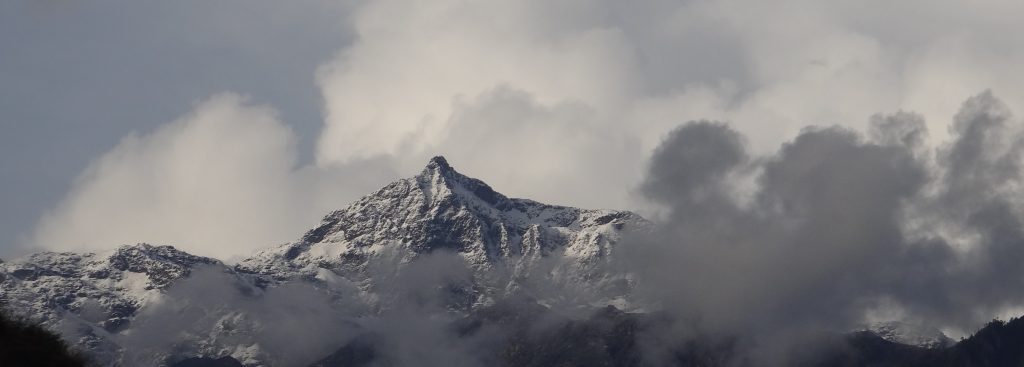
Max Elevation: 5, 005 m
Min Elevation: 2, 250 m
Difficulty: Hard
Season: April, May, June, September, October, November
No. of Days: 13 Days
Day 01: Arrival at the Paro International Airport. On your arrival, The Traveller Trails – Bhutan’s representative will receive and transfer to hotel
Later in the afternoon, you will have the following visits;
- National Museum
- Paro Dzong
- Drukgyel Dzong
In the evening, scroll down to Paro town/leisure
Overnight Paro
Day 02: Tiger Nest Temple
Hike to Tiger Nest Monastery as good for acclimatisation for the trek
Overnight Paro
Day 03: Paro – Chele La Pass
Another acclimatisation hike at Chele La Pass and, also visit to Nunnery Kila Gompa
Overnight Paro
Day 04: Gunitsawa Village - Sharna Zampa
This trek begins at Gunitsawa Village were you pass the army post. At the army checkpost your trek permit (provided by your tour operator) will be checked and endorsed. The campsite is on the opposite side of the river, not far from Gunitsawa
Distance | 40 km |
Time | 40 mins |
Ascent | ........... m |
Camp Altitude | 2,850 m |
Day 05: Sharna Zampa - Thangthangkha
On this long day, the trail continues with lots of small ups and downs. After going uphill through the river valley the valley finally narrows gradually to a mere path which descends to a meadow where a camp will be set up. From here, if weather permits, you will have the first great view of Mt. Jomolhari
Distance | 22 km |
Time | 7-8 hours |
Ascent | Ascent 770 m, descent 10 m |
Camp Altitude | 3,610 m |
Day 06: Thangthangkha – Jangothang
If you did not see Mt. Jomolhari the previous evening, you will still have a chance to get a great view early this morning. This morning the trek continues up the Paro Chhu valley which widens into patches of alpine meadow and scanty growths of forest. You will cross an army checkpoint along the way and enjoy a spectacular view of high mountain ridges and snow-capped peaks. In this area yaks and their herder’s homes become a regular feature of the landscape. Passing the villages Soe, Takethang and Dangochang is another asset on this day. After reaching Jangothang, one of the most beautiful campsites of the Himalayas, you will again have a spectacular view of Mount Jomolhari.
Distance | 19km |
Time | 5 – 6h |
Ascent | 480m |
Camp Altitide | 4,080m |
The rest day in Jangothang provides plenty of possibilities for day hikes with great views of lakes and snow capped mountains such as Jomolhari and Jichu Drake. There are good chances to spot some blue sheep on the upper slopes of the valley. Jangothang is a perfect environment for your acclimatization. You can also trek up to Tosoh or hike around the area. There are good short hiking trails in three directions. Jomolhari and its subsidiary mountain chains lay directly west, Jichu Drake to the north and there are a number of unclimbed peaks to the east.
Distance | 0 km |
Time | 0 mins |
Ascent | 0 m |
Camp Altitude | 0 m |
This is one of the longest days of the trek. A short distance from the camp the trail begins climbing rapidly for about half an hour and then becomes a gradual ascent to the Nyilila pass at 4,870m. While on the climb enjoy the surroundings. You might see herds of blue sheep grazing on the slopes of the mountains. From the pass you will have spectacular views of Mt. Jomolhari, Jichu Drake and Tsherimgang, all of them rising above 7,000m. It's a gradual descent to the camp where you will pass by some of the yak herder’s tents, made from yak wool. The herders use these tents while travelling to various pastures for their yaks. As you come down into the Lingshi basin, a beautiful U-shaped valley, you get a wonderful view of Lingshi Dzong on clear days. Tserimgang and its glaciers rise up at the north end of the valley. The campsite is next to a stone hut you reach just before Lingshi Dzong.
Distance | 18 km |
Time | 6-7 hours |
Ascent | Ascent 840 m, descent 870 m |
Camp Altitude | 4,010 m |
Today is the shortest walking day, and you can really take it easy. Shortly after starting you will reach a chorten below Lingshi Dzong. Here, you have the choice of staying on the main trail or taking a detour up to the Lingshi Dzong (4,220m), which sits right atop a high ridge. This Dzong is under reconstruction from a 2011 earthquake which damaged its central building. In addition to a very special atmosphere of mystic tranquility, Lingshi Dzong provides a great view over the valley. After Lingshi Dzong you will be passing the villages of Lingshi and Goyul. In Goyul, the stone houses are clustered together to form a small compact village that is unusual in Bhutan where settlements are usually scattered. On reaching the campsite at Chebisa you will have plenty of time to visit the village houses if you feel up to it. There is also a beautiful waterfall located behind the village that is worth visiting.
Distance | 10 km |
Time | 5-6 hours |
Ascent | Ascent 280 m, descent 410 m |
Camp Altitude | 3,880 m |
The morning starts with a long ascent behind Chebisa Village (2-3 hours) through a wide pastureland towards Gobu La (pass). On the way, you will see a few people herding yaks. There is also a great chance to spot large herds of blue sheep above the trail. After crossing Gobu La (4,410m), you descend into the valley, then climb again a little bit, before descending again to Shakshepasa (3,980), a large U-shaped valley. Climbing from here you will finally reach the campsite at Shomuthang, above a river, which is a tributary of the Nochu River.
Distance | 17 km |
Time | 6-7 hours |
Ascent | Ascent 890 m, descent 540 m |
Camp Altitude | 4,220 m |
Day 11: Shomuthang – Robluthang
You begin by climbing up the valley to view Kang Bum (6,526 m) and some edelweiss. After two hours of climbing you will reach Jhari La (4,750m), from where you catch the first glimpse of Sinche La, the pass you will have to cross the day after. The big snow peak in the north is Gangchhenta 6,840 m, better known as the Great Tiger Mountain. If weather is clear, Tserim Kang and the top of Jomolhari will be visible. The camp by the river is called Tsheri Jathang located in a beautiful wide and remote valley. Herds of takin, the Bhutanese National Animal, migrate to this valley in summer and remain for about four months. The valley has been declared a takin sanctuary. Climb up a little bit and you will reach the campsite at Robluthang in a rocky meadow.
Distance | 18 km |
Time | 6-7 hours |
Ascent | Ascent 700 m, descent 760 m |
Camp Altitude | 4,160 m |
Day 12: Robluthang – Limithang
The trek starts out with an initial 40-60mins ascent before gradually raising for another 1.5 hours through a boulder field. It is then a 1 hour steep ascent before reaching Sinche La (5,005m) – the final and highest pass on the trek if you don’t intend to continue the Snowman trek from Laya onwards. As you descend the far side of the passyou will see an impressive terminal moraine and a glacial lake at the foot of the valley. You can see classic examples of lateral moraines where the glacier has pushed rocks up both sides of the valley. Below the moraine, you cross the Kango Chhu and soon reach the Limithang campsite. The peak of Gangchhenta towers over the campsite even though it’s quite a distance away.
Distance | 19 km |
Time | 6-7 hours |
Ascent | Ascent 850 m, descent 870 m |
Camp Altitude | 4,140 m |
Today, you walk downhill all the way along a narrow, winding river valley. After a long time, the trail takes you through densely forested region. The trail leads you to the west side of Laya village. From the west of the village you will have spectacular views of Mt. Gangchhenta and catch Mt. Masagang. In the village centre is a community school and a basic health unit with a telephone connection. The campsite is located below the school.
Distance | 10 km |
Time | 4-5 hours |
Ascent | Ascent 60 m, descent 340 m |
Camp Altitude | 3,840 m |
The trail winds up and down along the river valley of Mo Chhu avoiding natural obstacles and affording breath-taking views of the raging river, feeder streams and waterfalls. Lots of ups and downs will lead you to Kohi Lapcha at 3.300 m. The trek then drops down to the large stream of Koina Chhu, where you will find the campsite of Koina.
Distance | 19 km |
Time | 6-7 hours |
Ascent | Ascent 260 m, descent 1,070 m |
Camp Altitude | 3,050 m |
Today you will have the last major climb of the Laya Gasa Trek. You will cross Bari La (3,740m), after which the trail descends all the way until you reach Gasa village (2,770m), where you will find the first restaurants since you started from Drukgyel Dzong. There also is a campsite close to Gasa Dzong. You will have to decide whether you want to stay in Gasa village or descend for another hour to the Gasa Tsachu (hot springs) and relax in the rejuvenating mineral waters. The Gasa Tsachu is one of the most popular hot springs in Bhutan.
Distance | 14 km |
Time | 6-7 hours |
Ascent | Ascent 740 m, descent 1,500 m |
Camp Altitude | 2,240 m |
Day 16: Laya Gasa Trek - Finish
This trek finishes in Gasa; this remote village is home to a distinctive and architecturally unique Dzong.
Transfer to Punakha.
Day 17: Explore Punakha
Explore Punakha valley with visit to Punakha Dzong. The majestic Punakha Dzong is built at the confluence of the two major rivers Phochhu (Male River) and Mocchu (Female River). In addition to its structural beauty, Punakha Dzong is notable for containing the preserved remains of Zhabdrung Ngawang Namgyel, the unifier of Bhutan and Rangjung Karsapani as well.
And, then visit to country’s longest suspension bridge hanging over Punakha valley.
In the evening, visit to Anim Dratshang – Nunnery Monastery at Wolakha
Overnight Punakha
Day 18: Punakha – Thimphu
While on transfer to Thimphu, you will stop at Lobesa for a small hike to Chimmi Lhakhang- the temple of fertility, located at the hilltop of lovely Lobesa valley. The hiking trails takes through the paddy fields and rural farm house.
We will stop at Dochhula pass (3,150m). The pass is adorned with 108 small stupas and beautiful prayer flags hanging over the spectacular pass.
If it’s a clear day, you will have the opportunity to see Eastern Himalayan Mountain Ranges beautifully.
Overnight Thimphu
Day 19: Explore Thimphu
While in Thimphu, you will have the following visits;
- National Memorial Chorten
- Kuensel Phodrang
- Simply Bhutan
- National Textile Museum
- Tashichhodzong
In the evening, transfer to Paro
Day 20: Paro - Depature
Transfer to the Paro International Airport to board flight to your onward destination.
Under Const...
Inclusions
- Bhutan Tourist tariff royalty & visa fees
- All private excursions and transfers in SUV vehicles
- Local English speaking trekking guide/tour leader
- Cook and camp hand who will take care of camp chores and provide wholesome meals
- Services of horsemen who will look after the yaks & ponies that transport luggage and camp gears
- Experienced Driver
- Accommodations at highest standard government approved hotels & guesthouses.
- All meals in Bhutan
- All entrance fees and permits
Exclusions
- All personal expense such as bars, beverages, laundry, telephone and tips
- Medical/Travel issurance.